A day trip to Speargrass Hut, Nelson Lakes NP
This was the second of the two day tramps I did over the weekend and
it was simply a hut bagging exercise. I have been down the Sabine Valley
before but never walked the whole Travers-Sabine Circuit (...but I will
be in April if the augurs work for me...) so I have not visited
Speargrass Hut before.
 |
| Mt Robert track network map |
The Kerr Bay DOC campsite:
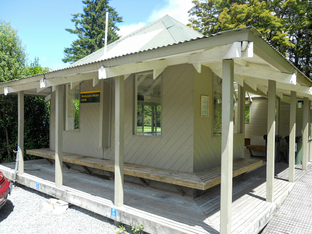
As I mentioned in the last post I stayed overnight at the
Kerr Bay camp ground near Lake Rotoiti. This is a very nice DOC camp ground. It has a well appointed cooking shelter with free cooking facilities (lights, potable water, gas hob, hot water heater) plenty of table space and bins for your rubbish. There are about 40 odd tent and caravan sites and all the amenities you would expect.
It also has token operated hot showers which is a real bonus...get the tokens at the St Arnaud DOC office.
 |
| DOC cooking shelter, Kerr Bay camp ground, St Arnaud |
 |
| Interior, Trampers cooking shelter, Kerr Bay camp ground, St Arnaud |
 |
| Dining tables, Trampers cooking shelter, Kerr Bay camp ground |
I had a nice flat spot for my tent on the nights I stayed, but it absolutely hosed with rain on the Friday night. I stayed dry in my
Coleman tent but it was a "near run thing' as the Duke of Wellington remarked. Everyone was a bit wet and bedraggled looking the next morning at breakfast...
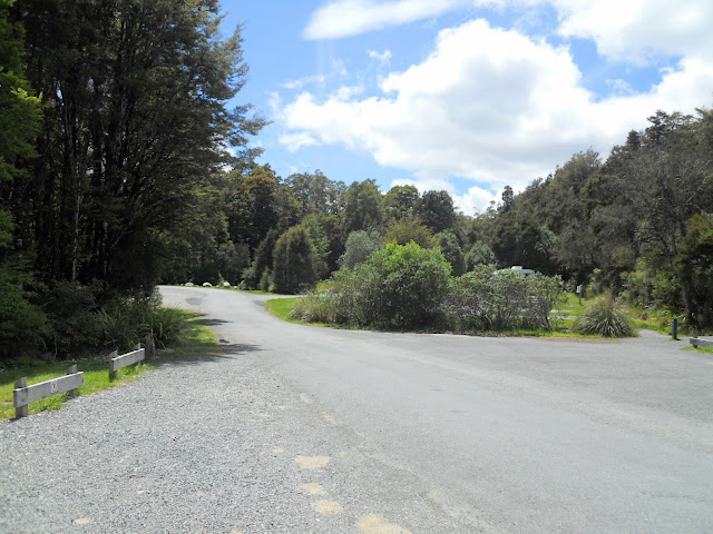
The camp ground was full, mostly tourists but there were a few kiwis as well, there are also two slightly more "rugged" camp-sites at
West Bay if Kerr Bay is full.
 |
| View up to tent/caravan sites, Kerr Bay camp ground, Nelson Lakes NP |
You can book a site on-line from December through Easter, the rest of the time it is first come first served.
Speargrass Track to Speargrass Hut
When I was in the Army we walked over Waiau Pass and down the Sabine Valley to the old track around Lake Rotoroa. The track around Lake Rotoroa is gone now, wiped out by a big storm about 3-4 years ago.
As it is only 2.5 hours from a car park I thought it a good candidate for a "baggin's"
 |
| Lake Rotoiti from the Mt Robert car park, Nelson Lakes NP |
The track is generally flat with a slight rise at both ends and takes approximately 2.5 hours each way, 5-6 hours return.They are relatively easy hours as well.
 |
| Track to Speargrass Hut, Nelson Lakes NP |
The start point for the Speargrass Hut Track is the Mt Robert car park. This is also the start point for the trip to Angelus Hut and the
Mt Robert Circuit. The views are nice as it sits just below the 900 meter line.
The car park was already half full when I arrived at 08.30 I would imagine most were either overnighting at Angelus or Bushline Hut or walking the Mt Robert Circuit.
 |
| A full Mt Robert car park, Nelson Lakes NP |
Note: Don't leave your car here over night! This is the site of more car break-ins than any other area of New Zealand bar South Auckland. I'm exaggerating a bit but not by much. This car park is specifically excluded on some insurance policies used by the car rental companies.
Basically, you need to park in St Arnaud, the best spot is outside the DOC Maintenance HQ near the visitors centre.
 |
| Day shelter and toilets at the Mt Robert car park, Nelson Lakes NP |
There is a
shuttle service during the summer to the car park, I think prices are around $20 per person.
 |
| DOC track sign at the Mt Robert car park |
 |
| Closer view of the DOC track sign at the Mt Robert car park |
 |
| Map of the local track network around Mt Robert and the Travers-Sabine Circuit |
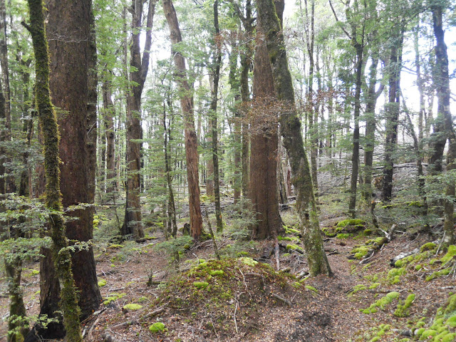
As I said, this is the starting point for both the Mt Robert Circuit and Speargrass Tracks. My track headed off to the right around the flank of Mt Robert ridge. The track sign doesn't specifically say 'this way to Speargrass" but that is the way to go. It is a very nice beech forest track, initially dropping down to Speargrass Stream and then gradually climbing to the tussock flat the hut sits on.
 |
| Start of the Speargrass Track at Mt Robert car park |
 |
| At the start of the Speargrass track |
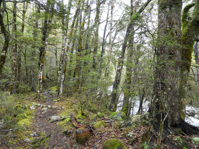
This track is all about root ladders and side streams; there are a lot of both to walk over. All of the side-stream have small foot bridges the exception being the river crossing near Speargrass Slip (more about that later). The track is a bit up and down but easy to follow.
 |
| One of the many sidestreams you cross on the Speargrass Track |
After an hour or so you descend right down to the bank of Speargrass Stream, the track follows the river for a good kilometre with a river crossing or flood track diversion near the infamous Speargrass Slip.
 |
| First view of Speargrass Stream from the Speargrass Hut track |
The river doesn't look too bad in this photo but brother was it deep and swift, I took a good hard look and thought "NO, bugger that for a laugh"! The pools in the river would be 4 feet deep and the water was whipping along and then under a series of nasty looking snags just hungering to drown somebody.
It is especially deep on the far side of the stream as it under cuts the river bank and has scoured out a deep channel. I used the flood track across the top of the slip instead, longer but much safer.
As always follow the golden rule of river crossings: if in doubt, don't cross...especially when there is a perfectly safe alternative.
 |
| Speargrass Slip and raised level of Speargrass Stream |
 |
| Speargrass slip...the flood track skirts the top of the slip! |
Here is a view of the river from the top of the Speargrass Slip flood track, you go quite a way up the slope to get around it.
 |
| Speargrass Stream from the flood track above Speargrass Slip |
After crossing the slip it was a series of gentle up and down sections all the way to the footbridge near Speargrass Hut. Your classic bog standard beech forest track....
 |
| Speargrass Hut Track: climbing out from Speargrass Stream to the hut |
 |
| Speargrass Hut Track, typical standard of track |
 |
| Speargrass Creek from the bridge near the hut, Nelson Lakes National Park |
 |
| Speargrass Track: the footbridge just before Speargrass Hut |
After 2.5 hours I arrived at Speargrass Hut which is one of the huts on the classic Travers - Sabine Circuit. The first question that popped into my mind was "Where is the speargrass....?" There wasn't any in the tussock clearing that I could see.
 |
| Speargrass Hut as seen from Speargrass Track...note the board walk! |
Speargrass Hut is very nice, it is a serviced 12 bunker and is relatively new having been built in 2006. The hut is always full as it is a crossing point on routes to Angelus Hut, the Sabine Valley, Lake Rotoroa, the D'Urville Valley, Blue Lake, Waiau Pass and other points to east and west.
It gets a lot of use, so it should probably be a 20 or 24 bunk hut.
 |
| Speargrass Hut (2006) |
I had a chat with the American guy who was in the hut, he was heading up to Angelus Hut using the Speargrass Stream route. Reading the hut book the majority of visits were from people on the Travers-Sabine Circuit and TA hikers who couldn't get over Waiau Pass and had to turn back.
 |
| DOC sign on the outside of Speargrass Hut, Nelson Lakes NP |
I would imagine they get a bit of snow around the hut in winter as it is sitting at over 1100 meters.
 |
| Speargrass Hut: the sleeping platforms |
I spent about 30 minutes at the hut eating my lunch and having a look around and then set off back to the Mt Robert car park.
 |
| Speargrass Hut: the dining area...nice view out the window by the way! |
I was kind of dreading the final climb from Speargrass Stream to Mt Robert car park. It was the last 30 minutes of a 6 hour tramp and it seemed like a long descent on the way in. Actually it was remarkably painless, in fact as I crested the last rise and saw the car park I thought "Unhhhh...is that it...?"
 |
| Speargrass Track: A footbridge over one of the un-named side streams |
 |
| On the last uphill section of Speargrass Track |
There are a few short sections of board walk on the Speargrass Track, there to protect areas of delicate alpine plants. I understand that there are extensive sections on the other side of Speargrass Hut as it descends Howard Ridge to Lake Rotoroa.
 |
| Boardwalk along the course of Speargrass Hut Track |
 |
| Another section of boardwalk on Speargrass Track, Nelson Lakes NP |
The track climbing to the car park is a 'root ladder', a type of track that is very common in Nelson Lakes NP. they are slippery but ok to walk on if you take your time.
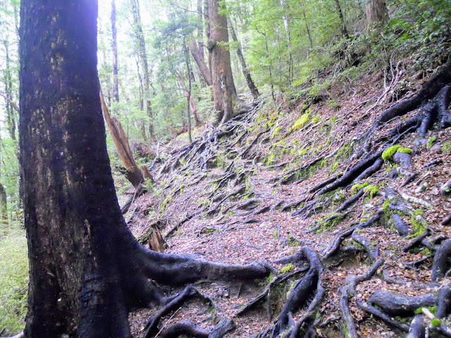 |
| Root ladder for a track, Speargrass Track |
 |
| At the end of the Speargrass Track, Mt Robert end |
If you are ever in St Arnaud you must drive up to the Mt Robert car park. It is well worth the effort as it sits at 900 meters and has awesome views down onto Lake Rotoiti, St Arnaud and the surrounding area.
 |
| Lake Rotoiti and St Arnaud from Mt Robert car park |
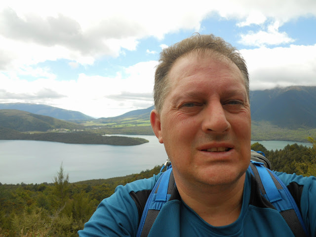 |
| Jon at the Mt Robert car park |
I stopped at West Bay on the way back to St Arnaud, you drive past it on the Mt Robert road. I used the lake to wash most of the mud and grime off my boots and gaiters and took some photos of the lake from near the dock.
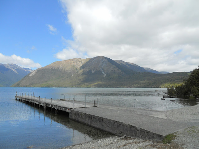 |
| Mt Robert Ridge from West Bay |
 |
| Lake Rotoiti Peninsula from West Bay |
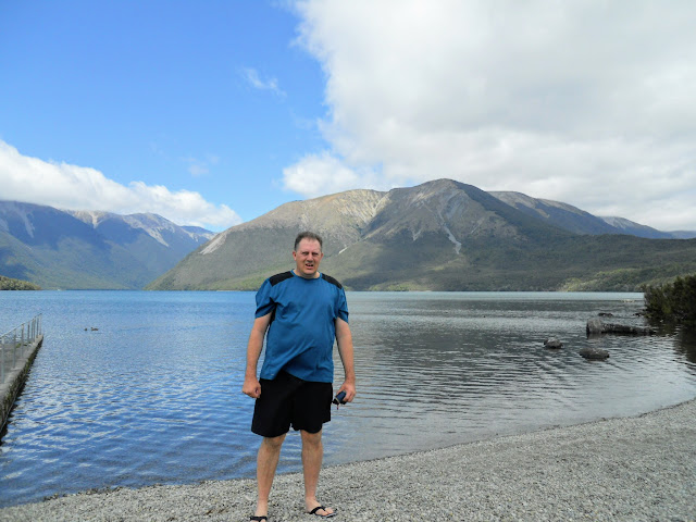 |
| Jon near the dock at West Bay, Nelson Lakes NP |
Another great tramp on a nice bush track, and lunch at a awesome DOC Hut, really what else could you ask for! Speargrass Hut is the 89th DOC hut I have visited....I'm closing in on that hundy fast!!!
Access: Speargrass
Valley Track can be accessed from the Mt Robert carpark, Lake Rotoiti.The obscure track heads off to the right from near the DOC track signs.
Track Times: It is approximately 10 km's to Speargrass Hut, or 3-3.5 hours. Total tramping time is 6-7 hours return.
Hut details: Speargrass Hut (Serviced, 12 bunks, watertank)
Miscellaneous: Need to negotiate the Speargrass Slip (flood track available).


