The newest tramping hut in New Zealand: Rod Donald Hut
The weather in the mountains was rubbish over the weekend so I decided to go for a short day tramp on Banks Peninsula. On Saturday I visited the brand new
Rod Donald Hut about an hour away from Port Levy Saddle.
 |
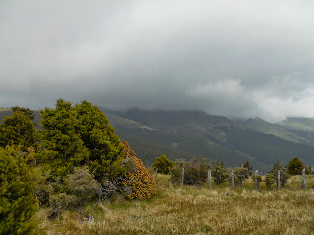
| Rod Donald Hut overlooking Western Valley, Banks Peninsula |
Day trip to Rod Donald Hut, Banks Peninsula
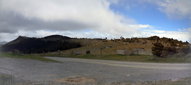
This hut only opened in October and is the next step in a long term plan to develop a series of multi day tramps on Banks Peninsula. Here is a
Christchurch Press article which discusses the new hut and the Rod Donald Trust who own the hut. Rod Donald was a Green Party MP with long standing ties to Banks Peninsula. The hut and surrounding bush will bear his name and are a fitting tribute to his environmental work over many, many years.
 |
| Te Ara Pataka: Port Levy Saddle to Rod Donald Hut |
You can now walk the
Te Ara Pataka track over 2-3 days from Gebbies Pass to Hilltop Tavern with a night spent in Packhorse Hut and another in the new Rod Donald Hut. This breaks it down into a 3 hour+5 hour+5 hour tramp. It is on the paper road along the crest of the ridges...this is the route proposed by Harry Ell back in the 1920's. All this land is privately owned farmland with a few scenic bush reserves between the various farms.
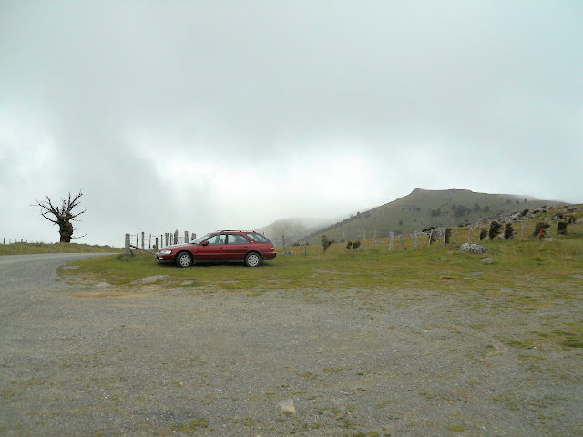 |
| The massive car park at Port Levy Saddle |
The Port Levy Saddle is accessible from Western Valley road just past Little River township, it is a steep, narrow gravel road but still usable by a two wheel drive vehicles. The saddle provides access to the Summit Walkway: turn north west for Mt Herbert and south east for Hilltop Tavern.
 |
| Start of Te Ara Pataka- NW to Mt Herbert |
 |
| Wide angle view of my direction of travel on Te Ara Pataka |
 |
| Start of the Summit Walkway- SE- my direction of travel |
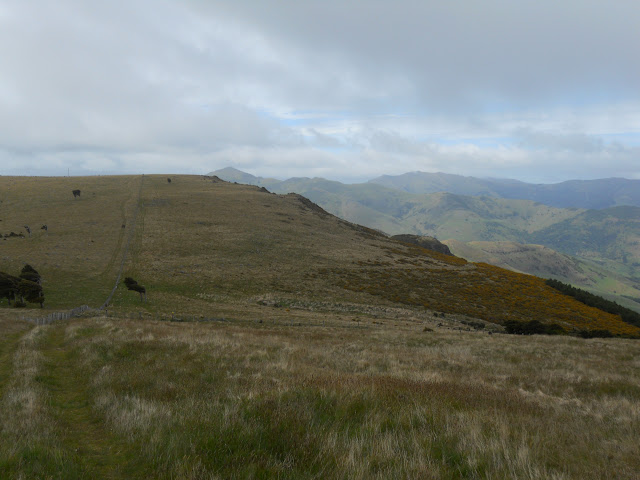
As you can see the weather was not fantastic even on Banks Peninsula, thankfully it improved as the day progressed. It wouldn't really matter though, it is only one hour to Rod Donald Hut from the car park so even if it is raining it is not too dangerous a proposition.
 |
| Me and the beast in the cold wind on Port Levy Saddle |
 |
| Port Levy from Te Ara Pātaka near Port Levy Saddle |
 |
| Start of Te Ara Pātaka at Port Levy Saddle |
 |
| View back to the Port Levy Saddle car park |
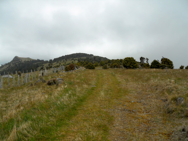
The Te Ara Pataka walkway starts out following an old farm track but then branches off with poles marking the route. You should follow the marked track as the rest of this area is private farmland and it would be good to be able to maintain the access the farmer has given across their land.
 |
| Te Ara Pataka: old 4 W/D track on way to Waipuna Saddle |
 |
| Te Ara Pataka: doesn't that weather look nice... |
The views kept disappearing into the low laying cloud, travel on Banks Peninsula has the same challenges of tops travel in the higher Southern Alps. You need to carry warm clothing and wet weather gear with you as it gets cold and wet very quickly up here.
On the positive side the views are awesome!
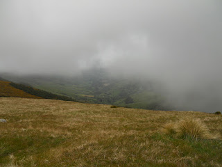 |
| Limited view of Western Valley from Te Ara Pataka |
 |
| Te Ara Pātaka Walkway meandering across the ridges |
|
Hmmm....must get a bit windy over Waipuna Pass if the extreme lean on this tree is anything to go by...
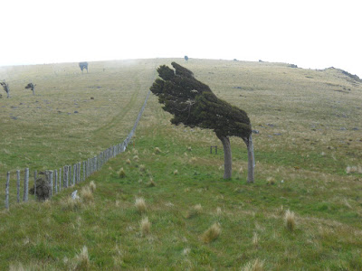 |
| Waipuna Saddle: I wonder which way the prevailing wind blows...? |
 |
| Summit Walkway heading towards Hilltop Tavern etc. |
The signs on the walkway and the turn off too the hut are really good as you can see from the next three photos. The hut track is clearly marked from both the Mt Herbert side and the Hilltop Tavern side.
 |
| Rod Donald Hut Track, the turn off to the hut... |
My cell phone worked here so if you haven't already booked a bunk for the night do it from the saddle. Obviously, you are so well organised this will not be necessary...!
 |
| ...another sign for Rod Donald Hut... |
 |
| ...and yet another sign for Rod Donald Hut!... |
You descend a surprising distance from Waipuna Saddle, probably 200 meters at least, but the track is well marked and not too steep.
 |
| Glimpse of the Rod Donald Hut from the access track |
 |
| Rod Donald Track: yes, it is an old sheep track... |
The trust who own the land are using the gorse as a natural nursery for native trees, eventually the natives will push the gorse out and this will be dense luxuriant native bush.
 |
| Gorse as a nursery plant for natives near Rod Donald Hut |
First part of the hut you get to is the wood shed, there are some good tips for chopping wood, necessary now that most of us never light a fire in our home. Will the ability to light a fire become a "lost art", judging by some of the ham fisted attempts I've seen in other DOC huts it is already an arcane one. There is a good supply of wood in the shed, and the stove is an old pot belly.
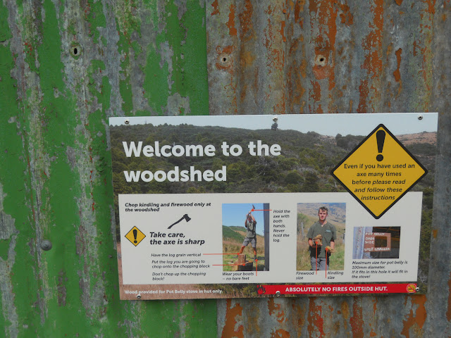 |
| Welcome to the Rod Donald woodshed! |
After about an hour you arrive at the hut. All I can say is WOW, it is a totally awesome hut and a fitting tribute to Rod Donald. It is an old farm building that has been gutted and converted into a hut and the
volunteers involved have done a fantastic job re-animating it. I'm sure it will become a must visit location both for Christchurch trampers and those from further afield.
Great job people!
 |
| Rod Donald Hut (2015) |
 |
| Jon at Rod Donald Hut: the porch |
 |
| Fancy composting toilet, Rod Donald Hut |
Both Packhorse and Rod Donald are now on the
DOC hut booking system, this is an excellent idea as it will ensure you have a place to sleep at the end of your tramp. It is a very reasonable $15 per night and all the funds go towards the upkeep of the huts and the Summit Walkway. I envision that this will become the first overnight stay for many new trampers over the years to come.
 |
| Upstairs bunk room (8 Beds), Rod Donald Hut |
 |
| Map of Te Ara Pātaka (Summit Walkway) |
 |
| View from the veranda at Rod Donald Hut |
 |
| Rod Donald Hut, nice new sign on door |
 |
| Interior of the Rod Donald Hut |
The kitchen and general areas of the hut have been well thought out, they are colourful, have plenty of space and great views of Little River and Western Valley from every window. There are two more bunks on this level.
 |
| Interior of Rod Donald Hut |
 |
| Me inside the Rod Donald Hut |
 |
| Little River and Western Valley from Rod Donald Hut |
The Rod Donald Trust have started extensive planting on the slopes surrounding the hut, this is going to be a stunning area of native bush in about 20-25 years with a range of three story species endemic to the Peninsula.
 |
| Another view of the outside of Rod Donald Hut |
 |
| Western Valley road heading towards saddle |
After chatting with the four Czech tourists in the hut and eating my lunch I headed back to the car for the trip home. You have to climb back up to the walkway from the hut but I found the climb surprisingly easy, the camber and state of the track made for good walking.
 |
| Bush and gorse along track from Rod Donald Hut |
Given the bend in these trees it makes you wonder at the ability of nature to survive in even the most extreme conditions.
 |
| Waipuna Saddle: must be windy up here...! |
 |
| Te Ara Pātaka,the track to Rod Donald Hut goes through the yellow gorse |
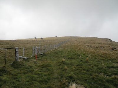
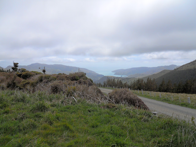
Below, you can see the track heading off into the distance following the fence line, three hours will see you at Montgomery's Bush, another two at the Hilltop Tavern over looking Akaroa Harbour. The track to the hut can be seen branching off to the right into the gorse, half way across the saddle.
 |
| Summit Walkway heading south east to Hilltop Tavern |
 |
| Crossing ridge, view of car park in distance |
 |
| Me near the farm gates at Port Levy Saddle |
As you can see some 'red neck' has been taking pot shots at the DOC sign. It looked like they were trying to make a "bullet face", they just weren't very good shots...
 |
| Bullet riddled sign near Port Levy Saddle... |
The track follows the contours of the ridge line shown in the photo below in a long sweeping left hand direction. It goes up over the bush covered crest on the left of shot and then drops down to Waipuna Saddle.
 |
| Te Ara Pātaka Track follows ridge line out to left of photo |
 |
| View out to Port Levy from the saddle |
You can clearly see the hut as you come back down Western Valley Road, it is at the apex of the zig-zag driveway pictured below. My understanding is that the driveway will be removed once the bush regenerates on this spur, leaving it cut off from road access. The driveway has a locked gate at the bottom just after leaving the access road.
The trust have started to plant on the slopes around and below the hut, eventually it will all be native bush.
 |
| The Rod Donald Hut from Western Valley Road |
Just a short trip but a tantalising taste of the
Te Ara Pataka or the Summit Walkway. I have already booked a spot in the two huts for the nights of 1-2 April 2016, I will be walking the track starting from Hilltop and walking back towards Gebbies Pass, this allows me to use public transport to get to the start of the track. Kathryn and the kids will pick me up from Gebbies Pass on the Sunday.
I look forward to the experience....!
Access: On the Akaroa-Christchurch
Highway, past Little River take gravel Western Valley Road to the car park at Port Levy Saddle
Track Times: 1 hour to Rod Donald Hut, 1.5 hours return
Hut Details: Rod Donald Hut: serviced, 10 bunks, wood burner, water tank, wood shed, toilets
Miscellaneous: On DOC Hut booking system, must be booked for overnight visit, this track is very exposed to the weather, care needed in strong wind, rain, cloudy conditions
 |
| The wildly over priced Little River Cafe |
P.S: I stopped at Little River to get a cold drink and while there checked out the food in the cafe attached to the store. They wanted $14.00 for a steak and cheese pie, $16.50 with salad on the side! A basic ham sandwich on white bread was $10.00! That is just atrocious...obviously priced for the massive numbers of tourists who pass by on the way to Akaroa.


