Walking on the Port Hills: a case of changing plans...
Ive been quiet on the tramping scene for a while so I planned a trip up to Lewis Pass, I was going to hike into Boyle Flats Hut for a couple of nights and then walk out.
I actually got as far as Hanmer Springs! About 2 km's past the Hanmer Springs turn off the road was closed:a logging truck had overturned this side of Lewis Pass blocking the road from 0730 till 1400.
Bugger! So no trip to the mountains this weekend:0
 |
| Jon walking in Hanmer Forest Park on the Friday |
I spent the day in Hanmer instead, went for a forest walk, spent about 3 hours in the thermal pools & then drove home. Altogether, not a waste of a day.
Setting out for the Bridle Path
The next day was clear and sunny so I decided to go for a walk on the Port Hills. I got my wife to drop me off at the top of Dyers Pass Road and then walked along the Crater Rim Walkway to the Bridle Path, about 10 kms in total. This was the first weekend since the 2010/11 earthquakes that the section of track from Rapaki to the Bridle Path was open.
It was previously closed due to rock fall danger.
 |
| The Port Hills from Dyers Pass to Mt Pleasent |
 |
| Sign of the Kiwi car park |
You start out walking up the road for about a kilometre then start walking on the track.
 |
| Heading up the Summit Road |
 |
| ...more of the the Summit Road |
This is Sugar Loaf (496 metres), it houses the TV transmission tower for the Christchurch area. That's its real name btw, supposedly it looks like a loaf of bread...I dont see it but....????
There are fantastic views from the top of the hill, you can walk up the access road to the third highest point on Banks Peninsula.
 |
| Sugar Loaf TV antenna in the distance |
The entrance to the track is opposite the first lookout on the Summit Road, there are a number of tracks from this location which lead up to the car-park at the Sugar Loaf.
 |
| Road side car park about 1 km up the Summit Road |
This is not a very auspicious start to the Crater Rim Walkway, scrubby sheep pasture, but the start it most certainly is!
 |
| Crater Rim Walkway: Climbing the track to Sugar Loaf |
 |
| Pegasus Bay and North Canterbury from the Port Hills |
The Crater Rim walkway goes around the left side of the hills from the Sugarloaf car-park. From this point on you have excellent views of the Canterbury Plains, Pegasus Bay and Southern Alps.
 |
| Sugar Loaf car-park, track goes to the left |
A classic view north towards Kaikoura, Pegasus Bay and the distant Southern Alps.
 |
| Glorious Canterbury Plains/ Pegasus Bay |
Here is view down onto the South end of Lyttleton Harbour with Gebbies Pass, Mt Bradley and Mt Herbert in the distance. Quail Island is to the middle left of the photo.
 |
| View of Lyttleton from near Sugar Loaf |
This is the style of sign used by the Christchurch City Council who administer the tracks and roads on the Port Hills. Note the message about rock fall: this was NOT on the sign before September 2011!!!
 |
| Crater Rim Walkway: a rock fall warning |
 |
| Crater Rim Walkway on flank of Sugar Loaf |
As you can see the established parts of the walkway are very easy to follow, this is the standard of the "track" for most of its length.
 |
| View to the East along the Port Hills |
There are two excellent tracks through some native forest on the Lyttleton side of Sugarloaf. Unfortunately since the earthquakes there is a very real risk of rock fall on the tracks. These tracks are now open again after some removal of loose rocks.
 |
| Looking West towards Sugar Loaf- just see native bush to left |
 |
| CCC Reserve sign...you see a few of these! |
View towards the mouth of Lyttleton Harbour, that is Quail Island in the centre of the shot. There is a very nice track around the Island, a great spot to take the kids for a walk and lunch during the Summer. You have to catch the ferry out to the island, unless you own a boat of course.
2021 Update: DOC and the trust in charge of Quail Island have developed a new 10-12 bunk hut on utilising the existing information centre and outbuildings. It was opened in early 2020 and is a fine first tramping destination for new trampers and those getting back into the outdoors.
 |
| Diamond Harbour in the distance |
 |
| Crater Rim Walkway near Mt Vernon |
There are a few areas of regenerating bush along the track, in pre-colonial days the whole of the peninsula was covered in dense native bush. There are planting groups working their way along the Port Hills but I would imagine it will be some time before the results are obvious.
 |
| Crater Rim Walkway- easy single track |
 |
| Crater Rim Walkway: exotic tree planting |
The track undulates up and down over small ridge-lines and through small areas of bush.
 |
| Crater Rim Walkway: sidling around Mt Vernon |
There are the foothills of the Southern Alps in the distance, they are about 50 km's distant in this photo. During that week they had a good fall of snow higher in the Alps, 6-10 cms which closed a lot of the passes.
 |
| Southern Alps in the distance from Port Hills |
 |
| Port Hills: Top end of Rapaki Track |
If you are walking the Crater Rim Walkway this is a possible spot to "bail out". The Rapaki Track will take you down to the Huntsbury area and "civilisation". Buses are available at the bottom to take you back into the central Bus Exchange.
 |
| Rapaki Track from Summit road |
Rapaki Track is a great downhill MTB ride, you have to look out for the tourist's though!
 |
| Rapaki Track heading down to Christchurch |
The section of Crater Rim Walkway between Rapaki and the Bridle Path has been re routed. Previously it ran along the Lyttleton side of the hills but because of rock fall danger it is now on the Plains side facing Christchurch.
 |
| End of the Summit Road for cars, Rapaki Track |
Parts of the track are dual use, I had to move aside for about 10-12 MTB riders through this section.
 |
Crater Rim Walkway on Huntsbury Spur
|
 |
| Crater Rim Walkway: View to ocean from Huntsbury Spur |
 |
| Lyttleton from near The Tors |
I stopped around 1230 by the side of the (deserted) road near the Tors and ate my lunch. It was very pleasant as it was surprisingly warm (its winter here). There was a nice views of the Plains and Lyttleton as I chomped my tuna + crackers!
Oh, mighty tuna, ambrosia of the God's, how I love thee!
 |
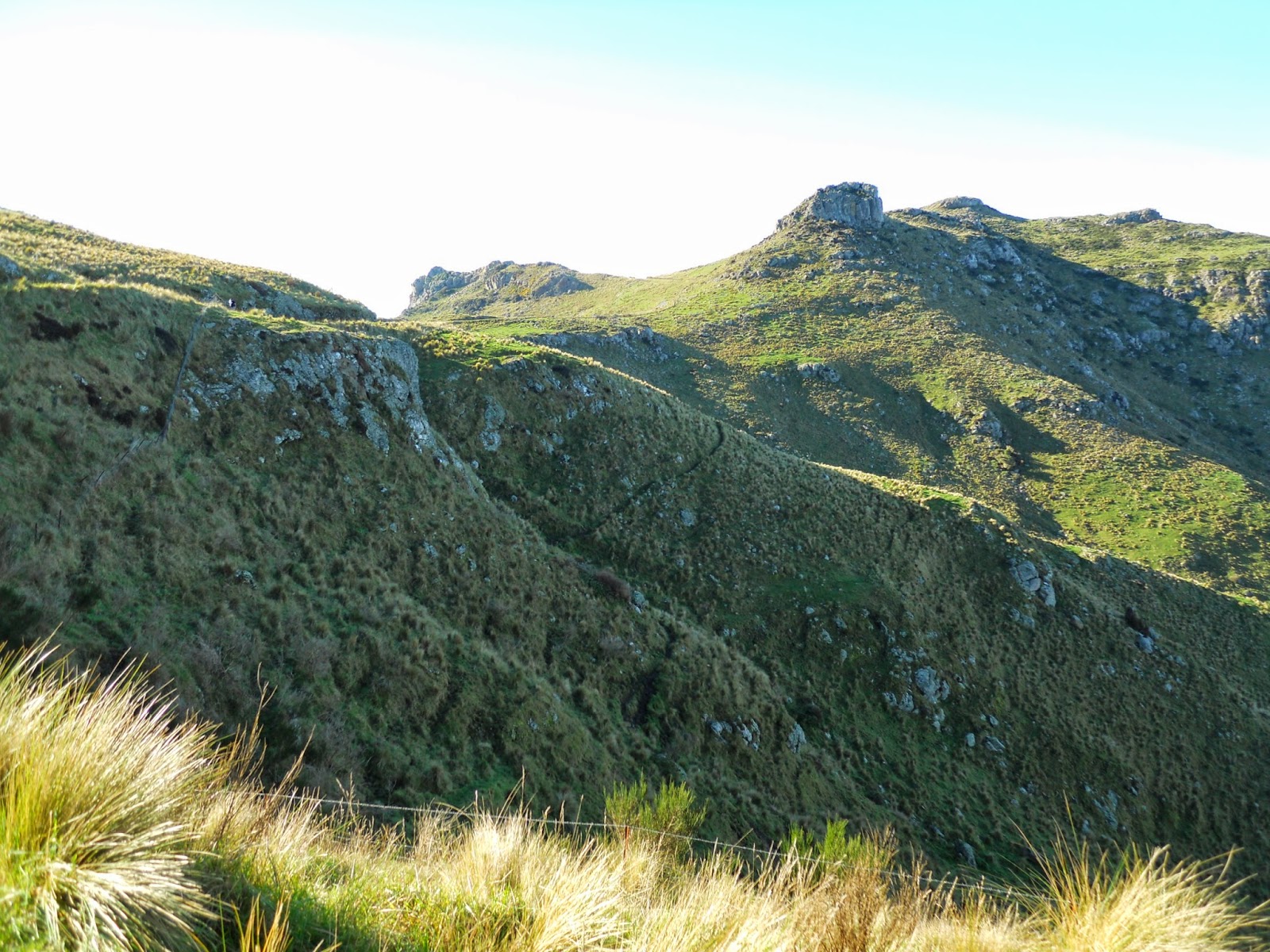
| View of the Tors near Castle Rock |
 |
| New section of the Crater Rim Walkway bedding in... |
Below is a view of the old walkway on the Lyttleton side of the hills, it has a series of unstable bluffs right next to the track so its a "no go" area now.
 |
| Old section of Crater Rim Walkway |
Track? What track are you talking about!
 |
| New section Crater Rim Walkway near the Tors |
Because the track has been re routed due to earthquake damage, you had to make your own way for about a kilometre. There are a series of paint marks on the grass so the CCC Parks and Recreation people obviously haven't got around to cutting the new track yet. It will sidle across the side of the hill following an existing sheep track.
 |
| View towards Castle Hill area |
 |
| Bridle Path apex from near Castle Hill |
 |
| Crater Rim Walkway heading down to Bridle Path on Pt. 422 |
The track heads around the back of this hill (Pt. 422) eventually to emerge at the apex of the Bridle Path. I decided to go off track and walk down the road. Dont do this! It was a pig of a thing to find a way down to the roadway as the road is built with an uphill cutting about 4 metres high. It would have been easier to just follow the path.
 |
| New section of Crater Rim Walkway on Pt. 422 |
At the apex of the Bridle Path
Here are a series of three photos from the Bridle Path apex, showing Lyttleton Harbour from the heads right through to Gebbies Pass.
 |
| Bridle Path view: Lyttleton Harbour Heads and the harbour |
 |
| Bridle Path view: Mt Herbert from Summit Road at Bridle Path |
 |
| Bridle Path view: View towards Quail Island, Gebbies Pass |
Heading down to Heathcote Valley
I stopped for a drink and snack at the top of the Bridle Path. There was a lot of foot traffic up and down the track because it was such a lovely day: Clear winter days seem to bring out Cantabrians for some fresh air and sunshine.
 |
| Hey folks, me at the top of the Bridle Path |
 |
| View down the Bridle Path towards Heathcote Valley |
Almost there, I come into sight of the track end!
 |
| Nearly there, Bridle Path car-park |
There are plenty of parking spaces at the track end, you can also park in the Gondola car-park which is right next to the Bridle Path.
 |
| Bridle Path car park |
Here are some para-gliders enjoying the day. They launch their gliders from a hill next to the top terminal of the Gondola.
 |
| Para-ponters near the Gondola |
 |
| Close up of Bridle Path sign in Heathcote Valley |
An excellent day out walking, the weather was beautiful, and although disappointed about missing my original tramp I was more than happy. I love the Port Hills we are so lucky to have them right there in our back yard.
Access: Crater Rim Walkway is accessible from multiple spots along the Port Hills. For this trip get someone to drop you at the Sign of the Kiwi at the top of Dyers Pass Road. Head up the Summit Road to the track to Sugarloaf. Stay on the Crater Rim Walkway from the Sugarloaf carpark.
Track Times: It is approximately 7-8 kilometers from the Sign of the Kiwi to the terminus at the bottom of the gondola. It will take you 3-4 hours to walk.
Miscellaneous: The Crater Rim Walkway is part of the Christchurch 360 Trail. No toilets/water sources anywhere from Sign of the Kiwi to the Gondola terminus. There is fall and rock fall hazards along the track. Watch for vehicles and bikes when crossing the roads. The Heathcote Valley side of the Bridal Path is steep, rocky and prone to rock fall.
Christchurch 360 Trail: Crater Rim Walkway: Mitchells Track-Crater Rim Walkway: Sign of Kiwi to Bridle Path - Crater Rim Walkway: Bridle Path to Evans Pass