Tramping the Abel Tasman Coastal Track
In September 2016 I had a plan to go and walk the Abel Tasman Coastal Walk, one of the ten "Great Walks" around New Zealand. I have previously visited both the ends of the track but have never tramped the section from Totaranui to Anchorage.
Unfortunately, the week I was due to walk the track a large storm rolled over the country putting an end to my plans.
 |
| Abel Tasman National Park: golden beaches, tidal inlets and forest covered coastal ridges... |
I always had it in the back of my mind to revisit the idea so to that end I present my Abel Tasman Great Walk from the 9-12th September.
Lewis Pass snowbound...!!!
To get to the Abel Tasman you have to get to the west coast via Lewis Pass, this just about scuppered my plan right from the start. Lewis Pass was closed due to snow fall on the day I was heading to Golden Bay.
Lucky for me the pass opened at 09:30 so I was delayed rather than prevented from getting to my destination.
 |
| Traffic waiting for Lewis Pass to open, Friday 9th September |
 |
| Traffic waiting for Lewis Pass to open, Friday 9th September |
There was quite a lot of new snow on the Hanmer Range as we head towards Lewis Pass. It didn't look too bad until...
 |
| Snow on the Hanmer Range, September 2017 |
...you got to Lewis Pass itself. Here the snow was 1-2 metres deep with a lot of fallen trees due to the weight of snow on them. I understood why the pass had closed when I got there.
 |
| Deep snow at the Lewis Pass car park, September 2017 |
The snow was especially heavy on the West Coast side of the pass...once past the Lewis Pass car park, it looked like you were in Sweden in winter rather than New Zealand in spring.
 |
| Heavy snow near Maruia Springs, Lewis Pass Highway |
I stopped in Murchison for a half hour break and went to have a look at the iconic WW1 memorial in their domain. This statute has been featured in several books as it was sculpted by a famous mid 20th century artist, it is in the classic 'soldier resting on arms' pose.
 |
| The war memorial at Murchison |
I finally arrived at Kaiteriteri/Marahau in the mid afternoon, it is now a 6-8 hour drive to get to Golden Bay from Christchurch due to speed restrictions and road repairs.
I was staying in Kaiteriteri but departing from Marahau, this allowed me to leave my car at the end of the track. I drove over to Marahau in the afternoon to check out the location of the water taxi office and secure parking.
 |
| Looking at the southern end of Abel Tasman National Park from Marahau waterfront |
 |
| The Aquataxi office and check-in point at Marahau |
I forgot how beautiful Kaiteri beach is...that golden sand they have up here is very attractive. I stayed at the
Kaiteri Beach Lodge which was clean, well appointed and relatively cheap this early in the year.
 |
| The golden beach at Kaiteriteri, September 2017 |
 |
| Kaiteriteri Beach Lodge, Kaiteriteri Beach |
I went for a meal at the
Beached Whale the café attached to the lodge as it was the only place open at this time of the year. The menu was limited but the fish and chips I had for $14.00 were very tasty. You could always go to Motueka for dinner...it is only 10 minutes drive away from Kaiteriteri.
Day 1: From Marahau-Totaranui by water taxi:
Travel within
Abel Tasman National Park is mostly done by water taxi: these are based at both Marahau and Kaiteriteri. I chose
Aqua Taxis as they operate from Marahau and this would allow me to get back to my car without relying on public transport.
 |
| Kaiteriteri Beach on my way to Marahau to catch the water taxi |
I thought it might be quiet on the water taxi but in fact they had six boats all leaving at the same time for different parts of the park. Mine had 16 passengers in it. The trip took about an hour in total with stops at some of the scenic spots along the coast to look at beaches, seals, penguins and other points of interest.
 |
| The water taxi meeting point at Marahau Sea Kayaking |
Aquataxis at Marahau have a fairly secure parking area close to their office for those of you using your own car to get there. Ask about it if you are leaving from Marahau.
Below is a photo of the water taxi I was on, you load up at Marahau Sea Kayaks and they drive you down to the launch ramp on the waterfront.
 |
| A boat from Marahau Aquataxi waiting to go! |
 |
| Pulling away from the boat ramp at Marahau |
On the way to Totaranui we dropped people of at various points along the coast. At Bark Bay we stopped near the beach side camp ground so the driver could point out the hut being moved off the beach. This is Rollos Hut, it belonged to the last permanent leaseholder in the area Rollo Wilkinson.
When the Abel Tasman National Park was gazetted in 1942 the owners of the existing bach's were allowed to keep them until the owner at the time passed away. Rollo pulled a nice trick and confounded both the NZFS and DOC by living to 92 years of age. Rollo passed away last year so the hut is being shifted to Marahau as a historic reminder of the many bach's and holiday homes that once existed in the park.
He sounded like a bit of a character and was well known for cheerfully
interacting with the people who stayed at the nearby camp-site over summer.
 |
| Rollo's Hut being prepared for removal, Bark Bay Campsite |
Only two of us got off at Totaranui: an older English woman call Helen and myself. She was going to
Whariwharingi Hut at the northern end of the park, then walking back to Marahau. We meet up again at Anchorage Hut on the Monday night.
I did the classic General MacArthur as I landed on Totaranui Beach...wet feet striding through the surf (unavoidable, the sea was rough), hat on, sunglasses lowered and purposefully staring into destiny...
A bit like this...
 |
| MacArthur lands on Luzon, 1944: from Time.com |
I just needed a swagger stick, my own personal LST, an ego the size of Texas and 200 photographers for it to be totally authentic...
 |
| Totaranui Beach looking to the south...yes the sand really is that colour! |
Totaranui to Awaroa Hut:
(7.2 km's or 2.5 hours)
As you can see the local DOC hut warden came down to check us out, he said "Quirlllllll....." which I took to mean " Welcome to Totaranui....have you got your hut booking form....?"
 |
| Warren the Weka comes to check me out...Totaranui Beach |
There is no town per see at Totaranui, only the
DOC camp ground and a few private bach's. If you wanted to start/finish the Great Walk at Totaranui you could camp here on the first/last night as the camp ground is open right through the year.
Note: over the Christmas break this is the busiest DOC camp site in New Zealand. It is probably already fully booked for this Christmas as well as Christmas 2018 + Christmas 2019!
 |
| DOC track network map, Totaranui Camp grounds, Abel Tasman National Park |
 |
| The DOC visitor centre at Totaranui Camp grounds, Abel Tasman National Park |
 |
| Map: Totaranui to Awaroa Hut, Abel Tasman Coastal Track |
The actual start to the
Abel Tasman Coastal Track begins at the southern end of the camp grounds...it is not sign posted you just get on the gravel road outside the DOC office, turn left and keep walking south.
 |
| Heading south to the start of the track, Totaranui Campsite, Abel Tasman National Park |
 |
| Camp site: Totaranui Camp grounds, Abel Tasman National Park |
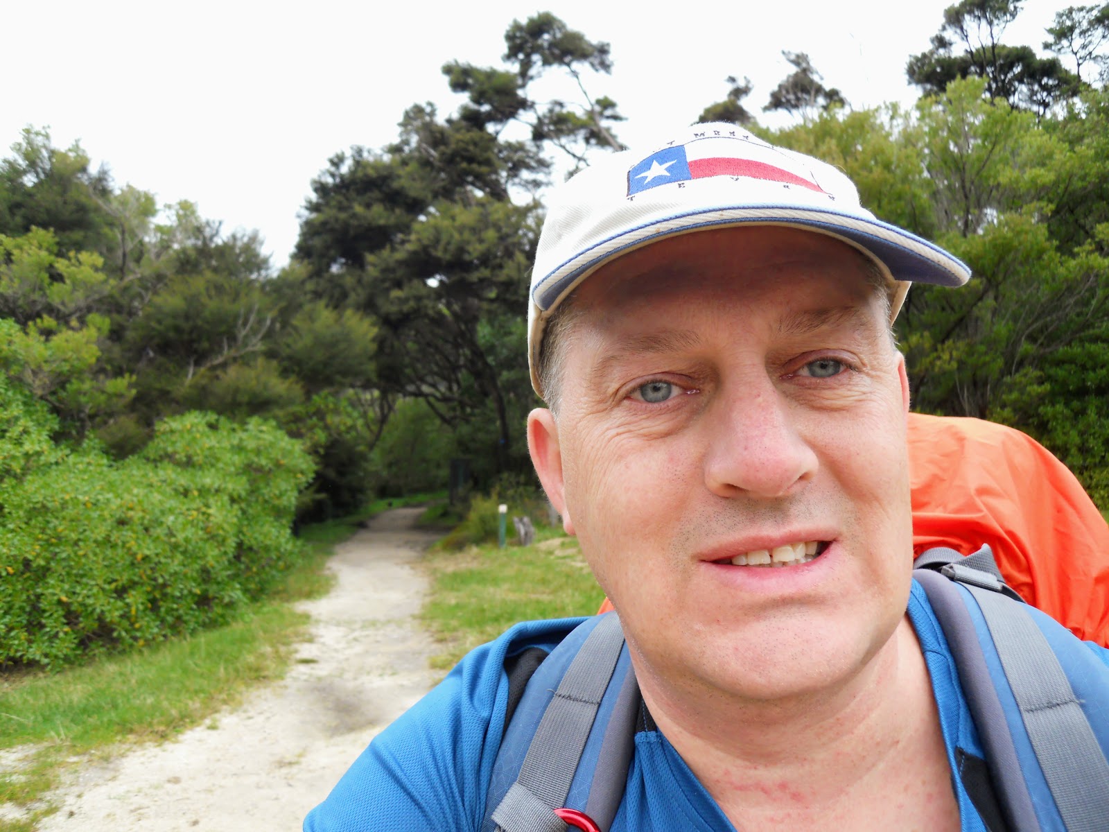
Below is the actual start of the walk, it is 52 km's (3-4 days walking) from this point to the end of the track at Marahau. I had the camp grounds and the first 3 km's of the track completely to myself.
 |
| Start of the Abel Tasman Coastal Track, Totaranui |
 |
| Jon at the start of the Abel Tasman Coastal Track, Totaranui |
 |
| DOC information at the start of the Abel Tasman Coastal Track, Totaranui |
You need to pre book and pay for all huts and camp-sites before you start the track, there is no freedom camping allowed ANYWHERE along the Great Walk. If you do not book you will be forced to pay double ($80 NZD per night) or they will put you on a water taxi (at your expense) back to Marahau.
You have been warned!
 |
| DOC information at the start of the Abel Tasman Coastal Track, Totaranui |
 |
| On the start of the Abel Tasman Coastal Track, Totaranui |
I decided before walking the track that I would check out all the scenic points offered along the track, the only one I missed was the 2 hour side trip to Falls River. The first was Skinners Point, from there you have a view of Totaranui Beach and the coastline in both directions.
 |
| Altitude profile for the Abel Tasman Coastal Track |
 |
| Skinner Point Lookout track junction |
 |
| The track to Skinners Point |
 |
| View of Totaranui Beach from Skinners Point |
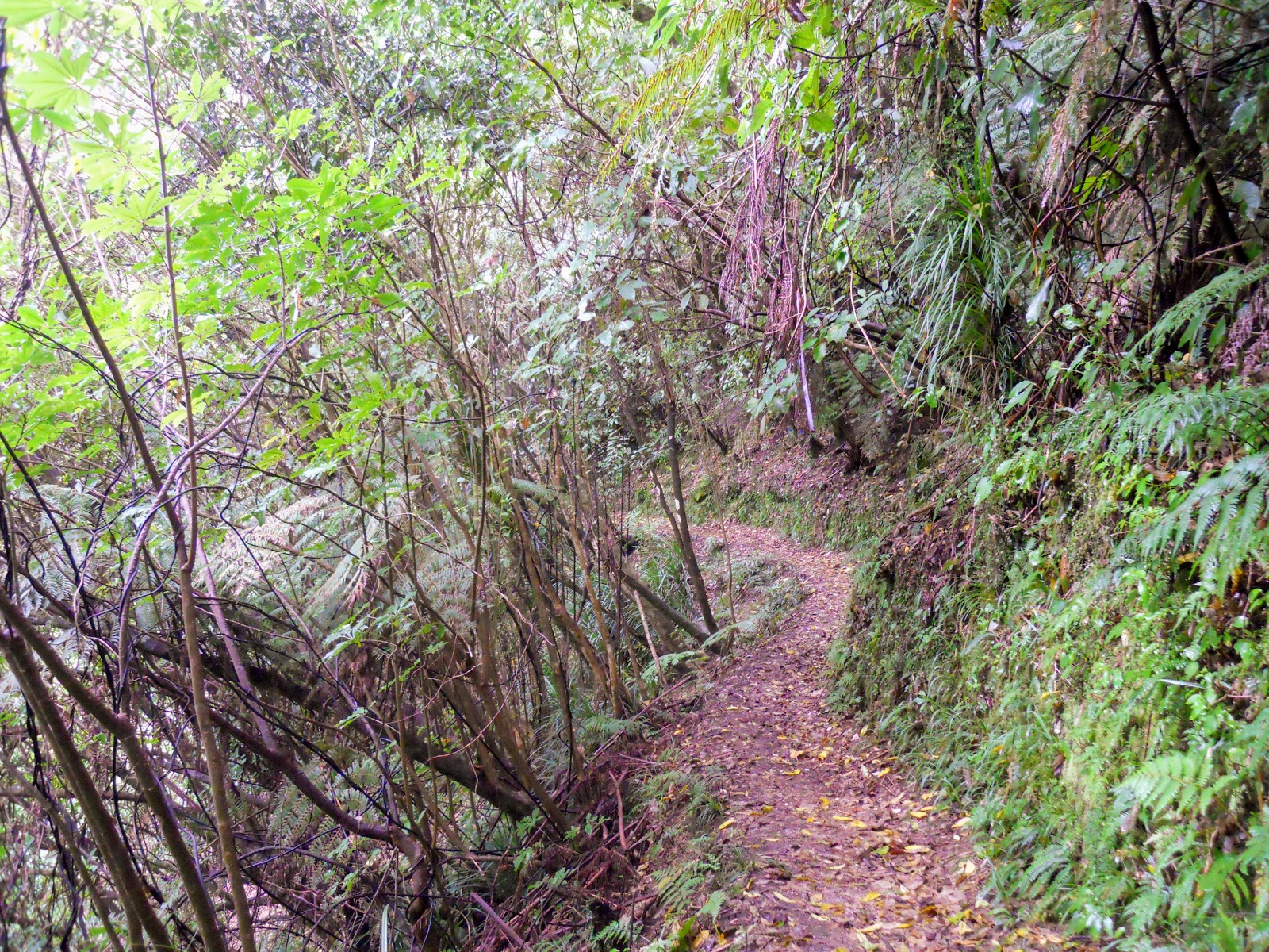
The official great walk season doesn't start until the 1st October so there is a fair bit of track work still being done. The quality of the track is very good for 80% of the time: smooth, level, nice gradients, every stream bridged (save two...more about that...) and covered in sand or gravel.
 |
| Track repairs under way, Abel Tasman Coastal Track |
For such a well used park the vegetation is extraordinary...the bush is as dense as any tropical jungle I have ever been in. I can see why they did jungle training here in World War Two.
 |
| Dense, jungle like bush next to the Abel Tasman Coastal Track |
 |
| Switch-back tracks heading down to Goat Bay, Abel Tasman Coastal Track |
Goat Bay is the first of many beaches you walk along on this track, the sand is really beautiful but much coarser than I imagined it would be. Its more like small ground up bits of rock than sand but I can still imagine sitting here quite nicely on a summers day.
 |
| Arriving at Goat Bay, Abel Tasman Coastal Track |
 |
| Goat Bay Picnic Area |
There was a young couple having lunch on Goat Bay beach, they were two of only three people I saw until I arrived at Awaroa Hut five hours later. It is real quiet at this end of the park.
 |
| Abel Tasman Coastal Track, the Goat Bay beach |
The track is not all that well marked: no small orange triangles here but obvious none the less as it basically follows the coast line.
 |
| Access to cliff side track section, Goat Bay, Abel Tasman Coastal Track |
 |
| My pack at the first rest spot at Goat Bay, Abel Tasman Coastal Track |
 |
| Track between Goat Bay and Waiharakeke Bay, Abel Tasman Coastal Track |
Waiharakeke Bay is the next beach you reach, this beach is quite long...about 1-1.5 kms. Watch the small rock outcrop you cross halfway down the beach as even at low tide the water laps around your feet. It is probably impassible at high tide.
 |
| Waiharakeke Bay Beach, looking south, Abel Tasman Coastal Track |
Waiharakeke Beach is roughly your half way point on this section of the track.
 |
| Half way between Totaranui and Awaroa Estuary |
There is a camp site at Waiharakakeke Beach...all these beaches have camp grounds and cooking shelters for your use...almost all empty this early in the season.
 |
| Waiharakeke Estuary and camp site, Abel Tasman Coastal Track |
 |
| Walking alongside Waiharakeke Stream |
 |
| Waiharakeke Stream, Abel Tasman Coastal Track |
I saw very few people at this northern end of the park: a couple at Goat Bay and one person at the Waiharakeke camp site. So early in the season the people are mostly down at the southern end of the park doing day trips or overnight trips not the full Coastal Track.
 |
| Swamp at the head of Waiharakeke Stream, Abel Tasman Coastal Track |
The side streams in the park have the same sand in them as the beaches...it kind of reminds me of the creeks you strike in the Solomon's as they look much the same.
 |
| Side creek at head of Waiharakeke Swamp |
 |
| Descending down into Pound Creek, Abel Tasman Coastal Track |
 |
| Arriving at Awaroa Inlet, Pound Creek |
The trip from Totaranui to Awaroa took me about 2.5 hours which is the posted DOC time.
 |
| A branch of the estuary of Awaroa Inlet, Abel Tasman Coastal Track |
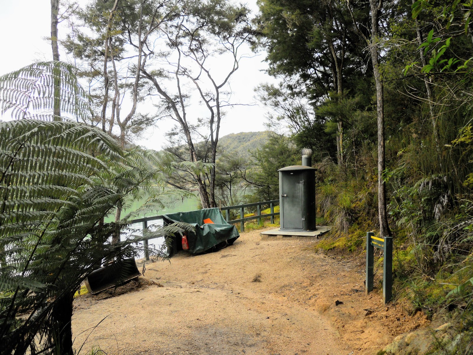
 |
| Toilet at the northern crossing of Awaroa Inlet |
 |
| Awaroa Inlet crossing point, north side |
One of the interesting aspects of this track are the tidal crossings you need to complete. There are several but the most important is the crossing at
Awaroa Inlet. Here you are only able to cross about 1.5 hours either side of low tide...there is no other way around. Once the water goes out it takes about 20-30 minutes to walk to the hut and camp-site on the other side of the inlet.
A bit of advice: take some camp shoes for the tidal crossings, the sand and shells are torturous on your feet. I had a cheap pair of knock off crocs from One Shoe Warehouse that worked a treat.
 |
| Awaroa Inlet, Abel Tasman Coastal Track |
 |
| Awaroa Hut on far side of estuary, Abel Tasman Coastal Track |
I had to wait for about 2 hours for the tide to go out, this was unfortunate but just part and parcel of walking this track. I confess I spent about an hour inside the toilet at Awaroa reading my book because it was the only way to avoid the sand flies. I should really have stayed at one of the Coastal beaches for the afternoon.
Piss poor planning and all that...
 |
| Tide going out at Awaroa Inlet, mid afternoon |
 |
| Jon at Awaroa Inlet- low tide in 30 minutes |
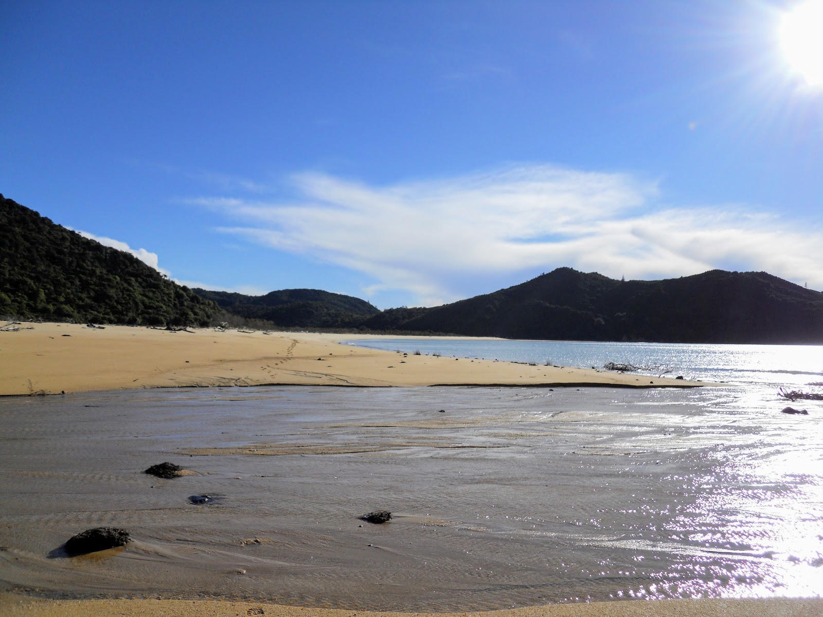
The tidal surge at Awaroa is spectacular: the inlet is huge but the water basically all disappears in about 45 minutes. As you can see in the photo below once the tide goes out is it relatively straightforward to just walk across.
The deepest water was in a channel mid way across; about mid thigh depth on me but moving very slowly. The people following me 10 minutes later had a almost dry feet trip.
 |
| At Awaroa Hut after crossing Awaroa Inlet at low tide...note two people crossing inlet |
Awaroa Hut was my first nights destination, it is very nicely appointed and has superb views out over the inlet. It is a 26 bunk hut with detached DOC rangers quarters, it has a large communal space and two 13 bunk rooms off to the side.
We were about half full that night: myself, a kiwi woman, an American woman, an Australian guy and a group of nine mixed French. The French got drunk...when they arrived they started pulling alcohol out of their packs, they had 10 assorted bottles.
Personally I didn't care as they were quiet boozers but it would have been a different story if there had been any kids there. Inappropriate, yes it was, but they were all about 22-23 and I'm sure I would have been the same at that age.
Ahhh...to be able to drink to excess without suffering a life shattering hang-over...remember those days!
 |
| Awaroa Hut, toilet block and amenities for Awaroa camp-site |
 |
| The Awaroa camp-site is 100 metres that way... |
 |
| Dining/living space in Awaroa Hut...before the French invasion! |
 |
| Other end of the dining/living space at Awaroa Hut...I love all that wood |
It was a pleasant night: we had the fire going (lots of wood), nice hut, plenty of good filtered drinking water, flush toilets...yep, they have flush toilets on this track. Makes a difference from your normal smelly long-drop, they even had toilet paper
...Toilet paper? Toilet paper you say...we didn't ave to-loit paper when I wer't a lad..tsk tsk...luxury, shear bloody Luxurryyyyyyyyy!!!!!
It rained for most of the night only halting at about 3 am.
Day 2: Awaroa Hut to Bark Bay Hut:
(12.5 km's or 4.5 hours)
I was up and away early the next morning...most of the people in the hut were heading north so they had to get up to cross at low tide which was at 05.45. I was happy as I wanted to get to Bark Bay Hut before the weather turned.
 |
| Low tide at Awaroa Inlet, morning of second day: Abel Tasman Coastal Track |
The mornings were invariably sunny and warm but there was rain every afternoon/evening starting from 3-5pm.
 |
| Map: Awaroa Inlet to Bark Bay, Abel Tasman Coastal Track |
You walk past the Awaroa camp-site on the way, it looks very nice (all the camp sites looked great), I would love to come camp here sometime in the summer.
 |
| Passing the Awaroa camp-site, Abel Tasman NP |
 |
| Dense ferns near Awaroa camp site |
There is a newly cut track from Awaroa hut to Tonga Saddle which completely avoids the old low tide crossing along the front of the private residencies at Awaroa. You are now able to access the Coastal Track in all weathers and all times of the day.
 |
| Starting the climb to Tonga Saddle on the new track section, Abel Tasman Coastal Track |
 |
| The sandbar at the mouth of Awaroa Inlet |
Great views from the new track...you can see as far as Separation Point in the far northern part of the Park as well as Awaroa Inlet and Totaranui beach.
 |
| Mouth of Awaroa Inlet, the private homes at Awaroa from the Abel Tasman Coastal Track |
 |
| Totaranui Beach and Awaroa sand bar from the Abel Tasman Coastal Track |
 |
| Awaroa airstrip from the Abel Tasman Coastal Track |
 |
| Part of the new track between Awaroa Hut and Tonga Saddle, Abel Tasman Coastal Track |
You meet up with the old track just past the turn off to
Awaroa Lodge and the airstrip. The old track was damaged by some slips, it is closed and I understand is being de-constructed by DOC.
You start to strike the first patches of mature podocarp forest as you get closer to Tonga Saddle...this is a stunning feature of the central section's of the track.
 |
| Mature Rimu Tree, Abel Tasman Coastal Track |
 |
| Northern half of Abel Tasman NP from Mt Rollinson |
 |
| Awaroa Eco Lodge from the Abel Tasman Coastal Track |
 |
| I'm heading for Bark Bay...3 hours from here! |
 |
| Mature Totara tree, near Tonga Saddle, Abel Tasman Coastal Track |
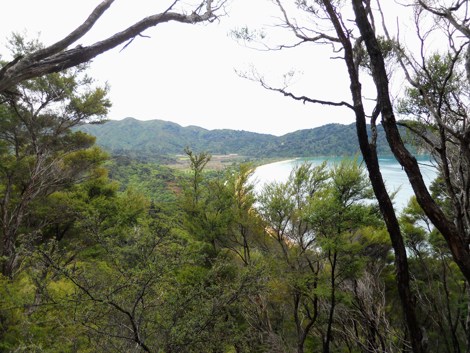
After about an hour you crest Tonga Saddle and start the gradual descent down to Onetahuti Beach.
 |
| First view of Onetahuti Bay from Tonga Saddle, Abel Tasman Coastal Track |
 |
| Richardson Stream mouth at Onetahuti Bay |
 |
| Boardwalk and bridge over Richardson Stream, Abel Tasman NP |
Ah nature...she likes her japes and jests. There used to be a problematic tidal crossing at Richardson Stream so DOC built a new $300 000 bridge across it giving a all tide track option. But you know nature, she hates a trier...in a big storm last year the flooded stream blew out the southern end of Onetahuti beach. There is now a tidal crossing there that is swift and chest deep at high tide.
Love your work mother nature...
 |
| The famous high tide bridge at Onetahuti Beach |
 |
| Crossing the bridge at Onetahuti Beach |
There were a lot of information boards along the track about the work of Project Janzoon.
Project Janzoon is a multi year plan for the restoration of Abel Tasman National Park to its original state. Eventually the valleys and hills will once again be covered in dense podocarp forest and this will bring back the native birds that once thrived here.
 |
| One of the Project Janzoon information boards |
 |
| Onetahuti Beach, Abel Tasman Coastal Track |
 |
| Tonga Island from Onetahuti Beach |
I was the first person to walk along Onetahuti Beach that morning.....
 |
| Tonga Saddle and Onetahuti Beach, Abel Tasman Coastal Track |
Below is the tidal crossing on the southern end of Onetahuti beach. It looks OK here but then it is nearly low tide...at high tide this crossing is chest deep and swift making it impassible.
This is what DOC is trying to ham-fistedly describe on the
Onetahuti Beach alert page for the Abel Tasman Coastal Track.
 |
| The DOC Track warning for the Onetahuti Beach tidal crossing |
 |
| The dangerous tidal crossing on Onetahuti Beach |
 |
| The dangerous tidal crossing on Onetahuti Beach |
The
Onetahuti campsite is 50 meters from the tidal crossing: it is very nice and has an excellent kitchen shelter with tank water. I stopped for a brew, some early lunch and a sit in the sun for about 45 minutes. The camp site is roughly half way between Awaroa and Bark Bay.
My olde pal Woderick the Weka stopped by for lunch at the same time...
 |
| Onetahuti campsite and cooking shelter, Abel Tasman Coastal Track |
 |
| Jon at the Onetahuti Camp Shelter |
 |
| Lunch at the Onetahuti camp shelter |
 |
| Wot's fow wuncheon J'won....Woderick the weka at the Onetahuti camp shelter |
The marking of the track is a bit spotty in places, the only two places I saw orange track markers was at the restart of the track past Onetahuti kitchen shelter and on the side tracks heading up to the Inland Track.
 |
| Onetahuti Beach: The only orange DOC markers I saw on Coastal Track |
 |
| Onetahuti Bay from the Abel Tasman Coastal Track |
 |
| Abel Tasman Coastal Track: between Onetahuti and Bark Bay |
Tonga Quarry camp-site is the roughest along the coast, it is the former site of an old quarry working from the 1890's. No kitchen shelter, toilet or water supply here...
 |
| Tonga Quarry camp-site: Spartan would be a good descriptive... |
 |
| Abel Tasman Coastal Track: Half way from Tonga Quarry camp-site to Bark Bay |
After another hour or so Bark Bay hove into sight through the trees. Once again there are low and high tide tracks to the hut and camp-site, the tide was full so I had to walk the extra 15 minutes around the head of the bay.
You should follow the high tide track; there are some very nice scenic views at the head of the lagoon.
 |
| First view of Bark Bay, Abel Tasman Coastal Track |
 |
| Abel Tasman Coastal Track: Waterfall Creek bridge at head of Bark Bay Lagoon |
 |
| The head of the Bark Bay lagoon, Abel Tasman National Park |
 |
| Waterfall Creek cascades, Abel Tasman Coastal Track |
 |
| Bark Bay Lagoon at high tide: the camp-site is on the sand bar, Bark Bay Hut to the right |
 |
| First view of Bark Bay Hut from the Abel Tasman Coastal Track |
Eventually you arrive at
Bark Bay Hut, I got there at about noon so that was 4.5 hours walking including 45 minutes at Onetahuti camp-site.
Bark Bay Hut was my favorite hut on this track, the location is great and that lagoon right outside the front door is awesome. It is the oldest hut on the track but in a lot of ways has the most character.
These mid 1980-90's wooden Lockwood/Fraemohs huts are just full of charm, that deep orange of the wood inside is very appealing.
 |
| Bark Bay Hut, Abel Tasman NP |
If this was any other country there would be a billion dollar hotel/resort built on this lagoon. Thank good for the visionaries who pushed for a national park in the area.
 |
| Bark Bay lagoon from the hut site, Abel Tasman Coastal Track |
Bark Bay has two bunkrooms: 34 spaces on sleeping platforms, a large communal area, it is fully insulated and double glazed, tapped fresh water in the hut, flushing toilets and it even has a cold water shower for the more hardy folks out there.
When I arrived a Nelson based father/son combination of trampers were on their way to catch the water taxi. They were two of only four other Kiwis I struck during four days of walking.
Why are we Kiwis not walking the Great Walks? If I lived up here I would be in Abel Tasman National Park every weekend....it would be my weekend stroll destination.
 |
| Bark Bay Hut: interior view of communal area |
 |
| Bark Bay Hut: interior view of fire and cooking area |
I was over by the window in bunk room number one, because I was there first I grabbed the best position in the room. Because there were just four of us I was able to have a 'tower o' mattresses' two high by two wide.
 |
| Bark Bay Hut: interior view of bunk room 1 |
 |
| Bark Bay Hut: interior view of bunk room 2 |
Here is a relic from the early days of DOC, this is a purpose built cabinet for the hut intentions book. Many of the older pre 1990 NZFS huts have these storage cabinets in them...
 |
| Bark Bay Hut: hut book case... this is a remnant of the 1980's |
It was hot on the Sunday, possibly 25 degrees. I went and splashed around in the water of the lagoon as I was contemplating a swim.....No Way...man it was freezing!
 |
| Bark Bay Lagoon, Abel Tasman National Park |
It rained for for about an hour in the afternoon which also chilled things down quite a bit. Every hut had the fire going at night. It was warm during the day but once the sun went down it got cold real quick. At least I had the hut warmed by the time my German companions arrived around 5 pm.
I shared the hut that night with a German woman and two younger German
guys. Katiji and I were both heading south while Hans and Frank were being collected from Awaroa the next afternoon. The lads had little food left so
I gave them my emergency rations: a cous-cous meal and an OSM bar I always carry when I go tramping.
I thought that a
lot of the people I saw or talked to were under prepared for
tramping in New Zealand, but you get that on the Great Walks.
 |
| I lit the fire at Bark Bay Hut... |
 |
| ...and filled the Bark Bay Hut wood box |
I went for a walk over to the camp-site and sand bar at low tide. The
camp site at Bark Bay looks like the nicest of the lot as it sits on a sand bar with the sea on one side, the lagoon on the other. There was a well equipped Canadian guy there I talked to for about 15 minutes. He was the only person I saw camping over the four days I was on the track.
 |
| Bark Bay Lagoon at low tide, Abel Tasman National Park |
 |
| The beach at Bark Bay- low tide, Abel Tasman NP |
 |
| Bark Bay kitchen shelter, Abel Tasman NP. Canadian camper... |
There is an old de masted catamaran moored at Bark Bay, it is the accommodation for the workers removing Rollo's Hut. They had gone to Marahau for the weekend, it being Sunday.
 |
| A de-masted catamaran berthed in the Bark Bay Lagoon |
 |
| Bark Bay Hut from the camp site...low tide, Abel Tasman NP |
I had a good conversation with Katiji who was a 32 year old architect from Berlin on a one year sabbatical. We meet up at the huts and encountered each other en route for the next two days. The two young guys were 18 and on a two month vacation after finishing high school. The lads (they really were lads...) later took off to one of the bunk rooms and watched movies on their smart phones for a couple of hours.
Sometimes I feel old when I'm around millennial's...it would never occur to me to download a movie and watch it while in a hut. Different generations really...I read books and leave them in the huts instead.
There was a Morepork calling right outside the hut for most of the night.
So ended day two of my four day trip....see my next post for days 3-4.
Access: Water taxi from Kaiteriteri or Marahau, the trip takes one hour from Marahau
Track Times: 7.2 km's or 2.5 hours Totaranui to Awaroa Hut, 12.5 km's or 4.5 hours Awaroa to Bark Bay
Hut Details: Awaroa Hut: serviced, 26 bunks, wood burner, filtered water tank, wood shed, flush toilets; Bark Bay Hut: 34 bunks, wood burner, filtered water tank, wood shed, flush toilets
Miscellaneous: On DOC Great Walk booking system, must be booked for overnight visit. Hut warden in residence from 1st October to 30th April each year. Tidal crossing at Awaroa Inlet and Onetahuti Bay.