In the shadow of Mt Rolleston...
On my way back from my recon of the Otira River I took the opportunity to go for a walk up the Otira Valley. The Otira Valley track can be located just over Arthur's Pass on the West Coast side of the mountains. The track goes up valley to the Northern face of Mt Rolleston and is an easy and very beautiful walk of about 2-2.5 hours duration.
 |
| Map of the Otira Valley track and surrounding area |
Walking the Otira Valley Track
The track can usually be walked in all seasons but there is extreme avalanche danger over Winter and Spring as there are high, steep mountains on both sides of the valley. The track is easy walking but if you are heading up here in Winter/Spring you absolutely need to know what you are doing.
 |
| Otira Valley from the car park on SH73 |
 |
| Otira Valley car park, with Arthur's Pass in background |
 |
| DOC track sign, start of the Otira Valley Track |
 |
| Start of Otira Valley Track, Arthurs Pass NP |
 |
| View to West from the Otira Valley Track |
About 5 minutes up the track you can follow a side track to Lake Misery, a medium sized tarn on the saddle at the Pass. It is a 20 minute walk and there is a board-walk and interpretive panels with interesting information about the area.
 |
| Track junction, Otira Valley Track - Lake Misery Track |
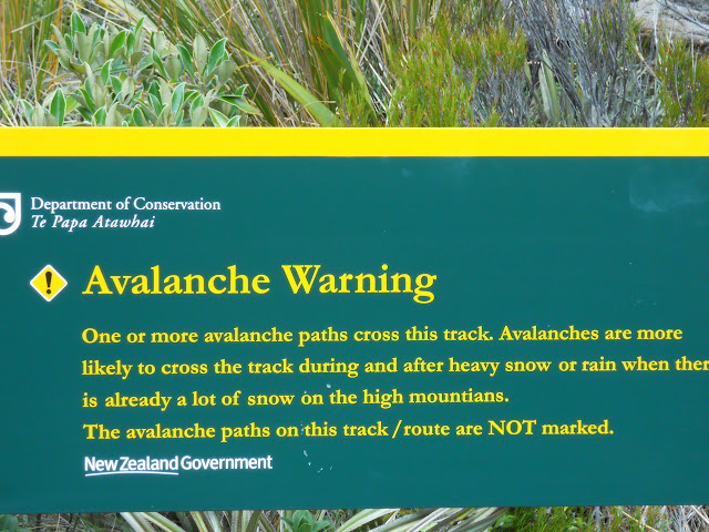 |
| Otira Valley avalanche warning...oh yes...they are not kidding! |
 |
| Looking west to SH73 from Otira Valley Track |
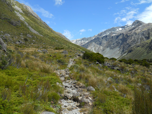 |
| Rocky section of the Otira Valley Track |
 |
| View onto alpine tussock land, Otira Valley |
There are great views across the to the North West side of SH73. You can see Temple Basin ski-field, one of the last club ski-fields in any New Zealand National Park. It is managed, maintained and for the use of the Club which owns the infrastructure. There is a fine access track to the ski lodge which makes another good day walk.
 |
| View towards Temple Basin Ski field |
 |
| Close up of Temple Basin from the Otira Valley |
 |
| View of the massive bluffs, west side of Otira Valley |
 |
| Pt 1728 from the Otira Valley Track |
There are some stupendous bluffs on the western side of this valley. They are easily 250+ metres high...these photos really do not show just how massive they are.
 |
| Otira Valley, 250+ meter bluffs around Mt Philistine |
 |
| View down to the footbridge in the upper Otira Valley |
 |
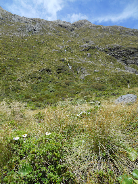
| Numerous waterfalls on Eastern side of Otira Valley Track |
I thought the flowers below were Mt Cook Lillies but have been informed that they are in fact
Common Mountain Lilly,
Celmisia semicordata which are endemic to the Otira Valley. There are certainly a lot of them growing in this area.
 |
| Common Mountain Lilly, Celmisia semicordata |
 |
Close up of
Common Mountain Lilly, Celmisia semicordata |
You cross a number of small side streams on the track, they do not pose a problem under normal conditions but could flood if there was a lot of rain.
 |
| Small stream, Otira Valley Track |
 |
| Waterfall on the East side of Otira Valley Track |
 |
| Beautiful pool in the Upper Otira River |
There is a foot bridge about an hour up valley, this is the end of the track and the start of the marked mountaineering route to the upper valley. You are relatively safe up to this point, past the bridge is the start of the rock/snow fall area. It is not surprising they have avalanches with the massive cliffs which loom over the track on both sides of the valley.
You should not go past the bridge in Winter/Spring without some knowledge of avalanche conditions as avalanches are a regular occurrence over those seasons.
Who wants to be squashed by a couple of thousand tonnes of rock and snow? Not me!
 |
| Footbridge over the Otira River...start of the mountaineering route! |
The bridge over the upper Otira River gets washed away about every 2-3 years and needs to be replaced, when you get a good old Nor' Wester blowing you can get massive amounts of rainfall over a short time span.
Flood city!
 |
| Western side of Otira Valley near bridge... |
 |
| Warning sign, Otira Valley Track |
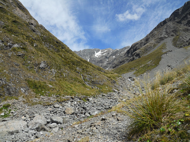
After crossing the bridge I continued another 2 km's up the valley before turning back. If you keep walking you eventually reach a mountain cirque just below the rocky northern face of Mt Rolleston.
I've visited the area before so didn't feel the need to go any further up the valley.
I headed back down to the bridge and stopped for a late lunch before starting back to the trail head.
 |
| Heading into the Upper Otira Valley... |
 |
| Pt 1728 on the far side of SH 73 from the Otira Valley Track |
 |
| Crossing rock fall path, Otira Valley Track |
Mt Rolleston at the head of the valley is not your classic pyramid shaped peak but rather one of the more common extended high ridges we have in New Zealand.. There are three significant peaks for alpine trampers & climbers to aspire to.
It can be climbed from the northern side but the common route is up the
Crow Face which is on the southern, more gentle side of the mountain.
 |
| Mt Rolleston, 2275m from the Otira Valley Track |
 |
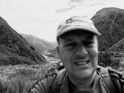
| Jon Moake, with Mt Rolleston in the background |
 |
| View from my high point, Otira Valley Track |
Below is a photo of the cirque in the Upper Otira Valley taken from
Annette Woodfords photography website.
The foot bridge is a nice possie to eat your lunch, it was warm in the Otira Valley and the sounds of the alpine birds and the river was very tranquil...
 |
| Lunch at the bridge, Otira Valley Track |
 |
| View of Upper Otira Valley from lunch spot |
It's difficult to see in this photo but all of those rocks have fist sized chunks of Pounamu (Greenstone/Jade) embedded in them. Pounamu has always been favoured by the Maori for decorative weapons and ornaments. This whole area is rich in Pounamu deposits but as it is a National Park so they cannot be taken.
It is awesome to see them in their natural setting.
 |
| Fist sized chunks of Pounamu embedded in rock in the Otira Valley |
This is a very nice day walk, slightly more adventurous than some in the area but certainly not outside most peoples abilities. You could certainly camp in the upper reaches of the valley and in fact I saw a party of three heading up valley for that reason. Just be careful in Winter/Spring because of the avalanche risk.
Access: Track starts just to the west of Arthur's Pass on SH73, there is a small car-park on the left of the road
Track Times: 1.5 hours to the foot bridge over the Otira River, another 1-1.5 hours to the cirque at the base of Mt Rolleston, same to return.
Miscellaneous:Extreme avalanche danger in Spring/Winter along all of this track. Do not enter the valley in heavy rain or after a late Spring snow storm. I'm really not joking...it looks ok but is awesomely dangerous until the snow pack melts.


